
Avata 2 in Remote Field Filming: What a Bridge Inspection
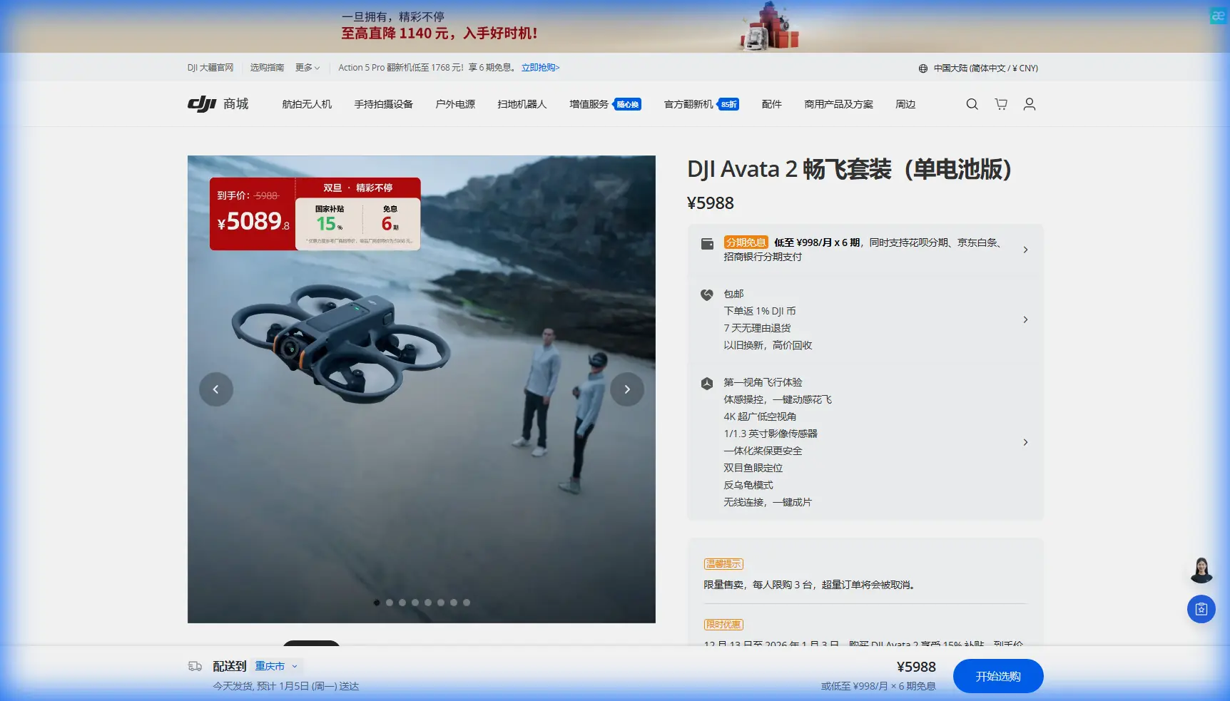
Avata 2 in Remote Field Filming: What a Bridge Inspection Workflow Reveals About Its Real Strengths
META: A field-tested look at how Avata 2 fits remote filming workflows, using bridge inspection photogrammetry principles like centimeter-level positioning, 360° underside coverage, and mixed air-ground image capture.
When people talk about the Avata 2, the conversation usually drifts toward speed, immersion, and FPV fun. That misses a more practical story. In remote field work, especially where access is awkward and terrain keeps changing, the real value of a compact FPV platform is not spectacle. It is coverage.
I came to that conclusion by looking at a bridge inspection photogrammetry workflow rather than a lifestyle shoot. On paper, it has nothing to do with filming open fields. In practice, it explains exactly why a drone like the Avata 2 can outperform bulkier camera aircraft in isolated locations.
The reference workflow describes an air-ground integrated approach for bridge inspection. Two details stand out. First, the system relies on centimeter-level positioning accuracy. Second, it uses a panoramic gimbal to add 360° high-resolution imagery under the bridge, while hand-carried cameras or even a phone can fill in the zones the drone cannot safely reach. That is not just an engineering note. It is a blueprint for smart remote filming.
Why a bridge inspection document matters to field cinematography
Remote field filming has a hidden problem: it is rarely just about what is in front of the camera. It is about what is missing from coverage.
If you are documenting farmland, irrigation lines, greenhouse edges, drainage channels, access roads, or the underside of rural crossings, a standard top-down or orbit-heavy drone workflow leaves blind spots. Some are caused by terrain. Some by line-of-sight constraints. Some by the simple fact that larger aircraft need more open space and more forgiving approach paths.
That is where Avata 2 becomes interesting.
Its value is not that it replaces every mapping or inspection platform. It does not. The point is that remote visual work often resembles the logic of bridge inspection more than people admit. You need to move from open air to constrained angles. You need repeatable framing. You need a stable path close to structures and land contours. And you need a way to patch visual gaps without overcomplicating the mission.
The bridge inspection solution shows a mature way of thinking: combine aerial imagery with supplemental ground capture so the final visual record is complete, not just dramatic. For anyone filming remote fields, that mindset is far more useful than chasing specs in isolation.
A case study mindset: filming fields in remote terrain
Imagine a photographer tasked with documenting a remote agricultural property over several visits during a growing season. The deliverables are not limited to hero footage. They include:
- wide context shots of field layout
- low passes along crop lines
- access path documentation
- culverts, small bridges, and drainage structure coverage
- visual records of terrain changes after weather events
- footage that can be edited both for storytelling and operational review
This is where many drones begin to split into two categories. One group is excellent at broad, elevated establishing shots. The other group can safely work close to terrain and structure. Avata 2 sits in a very useful middle ground for operators who need to move through remote spaces without carrying a larger, more fragile setup.
The bridge reference highlights support for consumer-type drones in a professional solution. That matters because it confirms something many field creators already know: a compact aircraft can be part of a serious documentation workflow if the operator understands how to structure coverage.
Avata 2 fits that logic well. In remote areas, the ability to launch quickly, reposition often, and capture angles that would be cumbersome with larger systems becomes operationally meaningful. You are not just saving time. You are preserving momentum in places where battery swaps, walking distance, and changing light all carry a heavier penalty.
The operational significance of centimeter-level positioning
One of the most useful details in the source is the emphasis on centimeter-level positioning performance. In a bridge inspection setting, this supports control, accuracy, and reconstruction quality. For remote field filming, the significance is slightly different but still substantial.
Precise positioning helps in three ways.
First, it improves repeatability. If you are returning to the same field every week or every month, consistent flight paths make your footage more valuable. You can compare crop development, water levels, equipment tracks, or erosion patterns without relying on rough visual guesswork.
Second, it supports cleaner integration with ground-based material. The source specifically references an air-ground workflow where RTK supports control and scene imagery. Even if your final output is not a formal survey product, the principle still applies. Better positional confidence means your low-altitude passes, reveal shots, and structure-adjacent clips can be edited into a coherent visual narrative rather than a disconnected collection of dramatic moments.
Third, it reduces wasted effort in remote conditions. Out in the field, retakes are expensive. If the sun drops, wind shifts, or the road back is long, precision is not a luxury feature. It is what keeps a short shooting window productive.
Avata 2 is not usually the first aircraft people mention when discussing disciplined repeatable capture. That may be a mistake. In remote filming, the best platform is often the one that lets you reliably capture the exact angle you need near terrain, not the one that only looks strongest in open sky.
The overlooked power of underside and edge coverage
The source mentions a 360° high-resolution imaging approach for bridge undersides using a panoramic gimbal. That specific hardware setup belongs to the inspection solution, but the lesson translates directly to Avata 2 workflows: valuable imagery often lives underneath, beside, or just beyond the obvious shot.
In agricultural and rural filming, that could mean:
- the underside of a narrow crossing over an irrigation ditch
- the shadowed face of a levee or embankment
- the interior edge of a shed opening
- the low side of a tree line protecting field boundaries
- drainage outlets hidden by slope and vegetation
Traditional camera drones can capture some of this, but they often do it awkwardly. Avata 2’s form factor and FPV-oriented handling make these edge cases much more accessible. This is exactly where it can excel against competitors that are happier hovering above the scene than entering it.
That comparison matters. Many drones can produce polished aerial footage of a field. Fewer can move confidently from open rows into constrained, low-clearance visual spaces and back out again without turning the shot into a risk management exercise. Avata 2’s real advantage shows up when the filming brief is spatially complex, not merely scenic.
Obstacle awareness matters more in the countryside than people expect
Remote fields sound open. They rarely are.
You get wire fences, poles, irrigation rigs, tree edges, uneven embankments, sheds, culverts, parked machinery, and narrow access routes. The visual simplicity of a field often hides a maze of collision hazards at low altitude. That is why obstacle awareness and route discipline matter so much.
This is also where feature lists need interpretation. Obstacle avoidance is not just for beginners trying not to crash. In professional civilian filming, it acts as a confidence multiplier. It allows the operator to focus more on line, speed, and framing when moving through visually cluttered rural spaces.
The same goes for subject tracking and tools often grouped under convenience features. ActiveTrack-style functionality, QuickShots, and Hyperlapse modes are not replacements for planning. But for solo field creators, they reduce workload in conditions where you may already be managing wind, changing light, and long distances from support.
The difference with Avata 2 is that these tools can be layered onto a platform that is naturally stronger in close-proximity movement than many traditional aerial cameras. In other words, the software features are useful, but the aircraft’s physical confidence in tight spaces is what makes them practical.
D-Log and the reality of remote light
Remote field filming often means harsh contrast. Open sky, reflective water, dark culverts, tree shade, bright soil, and patchy cloud can all appear within a single minute of flight. This is where D-Log or similar flat recording profiles become more than a box on a spec sheet.
If your assignment mixes broad landscape context with structure-adjacent passes, color flexibility becomes critical. The bridge inspection reference is fundamentally about building a complete visual record from multiple viewpoints. To do that well in a film or documentary context, your footage needs grading headroom. Otherwise, the transition from bright open field to shaded infrastructure footage feels abrupt and amateurish.
Avata 2 is especially compelling here because it can gather footage from more varied vantage points than many larger drones operators are willing to risk. That only pays off if the files can be brought together cleanly in post. Flat capture helps close that gap.
The smartest workflow is still hybrid
One of the strongest ideas in the source has nothing to do with drones alone. It explicitly says that in bridge undersides or complex terrain, operators can use a handheld camera or phone to supplement the bridge inspection system where the aircraft cannot reach.
This is the most useful professional habit remote field shooters can borrow.
Do not force the drone to do everything.
Use Avata 2 for the moving low-altitude transitions, constrained-angle reveals, structure-adjacent passes, and immersive lines through the landscape. Then step in on foot for static details, close texture, signage, equipment panels, culvert interiors, or any point where visual confirmation matters more than flight elegance.
That hybrid workflow is efficient, safer, and usually better looking. It also creates a stronger final story because the viewer understands not just the scale of the site, but its surface condition and operational details.
If you are building this kind of workflow and want to compare setup ideas for rural documentation, this direct field workflow chat is a sensible place to start.
Where Avata 2 stands out against competitors
The easiest way to compare drones is with broad categories like image quality, battery life, or speed. For remote field filming, that is too shallow.
A better question is this: which aircraft keeps coverage intact when the assignment moves from open land to awkward geometry?
That is where Avata 2 has a real edge. Many competitors are superb at stable elevated footage but become less comfortable when the operator needs to inspect the visual character of a drainage crossing, slip under a canopy edge, trace along a narrow farm track, or work near irregular terrain. Avata 2 is built for immersive navigation, and in civilian documentation work that translates into more complete footage with less compromise.
Not always prettier footage by default. More usable footage.
That distinction matters.
What remote operators should take from the bridge inspection model
The bridge reference is not secretly about one drone model. It is about a disciplined visual system. For Avata 2 users, the key lessons are straightforward:
- accuracy matters because repeatability matters
- underside and side-angle coverage are often where the real story is
- compact consumer-class aircraft can serve serious field documentation
- 360° or all-around visual thinking beats single-angle shooting
- hybrid air-ground capture is often the fastest path to complete coverage
The source even notes an electronic shutter range from 8 seconds to 1/8000 second, a reminder that imaging systems in documentation workflows must handle both low-light and high-brightness conditions. In remote field production, that same flexibility matters when dawn mist gives way to hard midday sun or when shaded drainage structures sit beside reflective open ground.
Seen through that lens, Avata 2 is not just an FPV drone for expressive flying. It is a practical visual tool for remote civilian work where access, angle, and continuity decide whether a shoot is merely attractive or genuinely useful.
That is the real takeaway. The best remote field footage is rarely the widest or the highest. It is the footage that closes the gaps.
Ready for your own Avata 2? Contact our team for expert consultation.