
Surveying Windy Power-Line Corridors With Avata 2
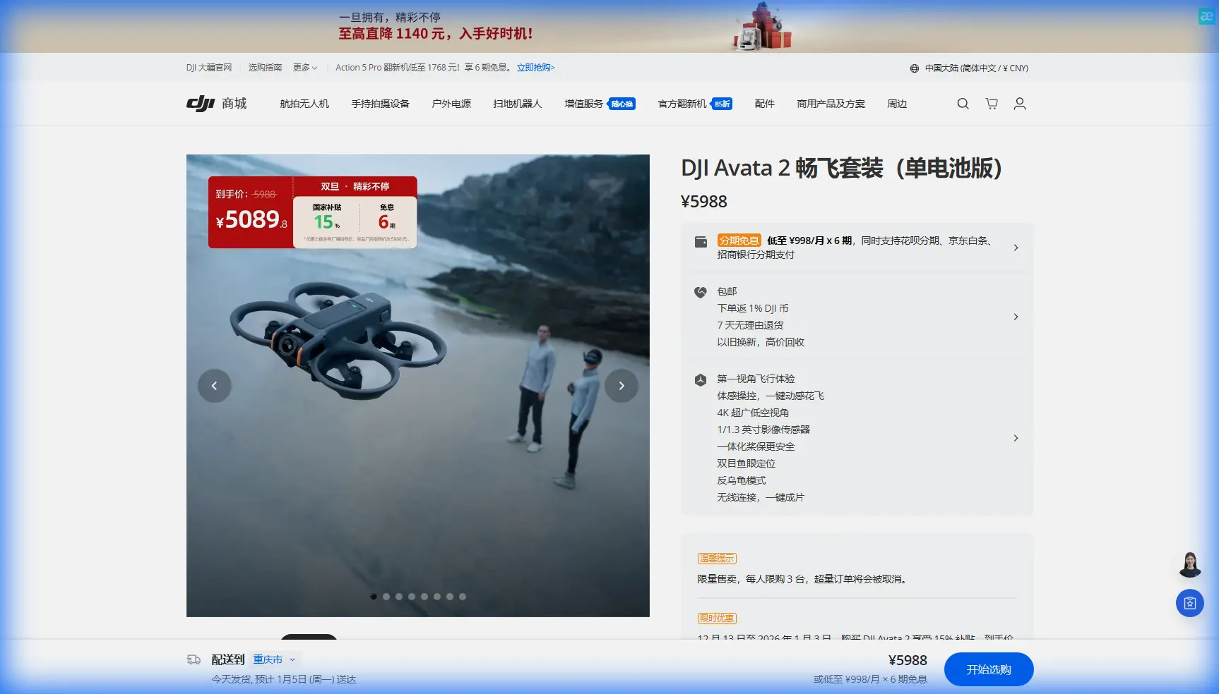
Surveying Windy Power-Line Corridors With Avata 2: What Actually Matters in the Field
META: A technical review of using DJI Avata 2 around windy power-line corridors, with practical notes on interference handling, flight behavior, obstacle awareness, and what photogrammetry limits mean for real survey work.
Power-line inspection and corridor surveying ask a lot from any drone. Wind pushes the aircraft off line. Towers create clutter. Conductors challenge both depth perception and route planning. Add electromagnetic interference and the margin for sloppy technique disappears.
That is exactly why Avata 2 deserves a more careful discussion than the usual “can it fly near structures?” treatment. It is not a conventional mapping platform, and treating it like one leads to bad expectations. Yet in the hands of a disciplined operator, it can still play a useful role in corridor reconnaissance, visual inspection support, pilot training, and short-range documentation in places where agility matters more than textbook photogrammetric output.
The real question is not whether Avata 2 can “do surveying” in the abstract. The better question is where it fits in a power-line workflow, especially when the site is windy and electromagnetic conditions are unstable.
Avata 2’s strengths begin where larger survey aircraft get awkward
Power-line routes are full of tight geometry. There are tower bodies, crossarms, insulators, access tracks, vegetation encroachment zones, and abrupt terrain changes. In these spaces, Avata 2’s compact FPV-style airframe has one immediate advantage: it can be positioned with intention around structures without requiring the same amount of turnaround space as a broad-winged mapping drone.
That matters in wind. A smaller aircraft is not automatically “better” in gusts, but nimbleness has operational value when a pilot needs to reposition quickly after a crosswind push or hold a safer offset from wires and hardware. In corridor work, the ability to abort a line, back off, and reset cleanly is often more useful than raw endurance numbers.
This is where obstacle awareness also becomes practical rather than promotional. Around transmission assets, obstacle avoidance is not a magic shield. Thin conductors remain visually unforgiving for any aircraft and should never be treated casually. But situational sensing still helps reduce pilot workload when maneuvering near tower elements, access roads, embankments, and vegetation. It supports safer flight discipline. It does not replace it.
For readers coming from camera-drone workflows, that distinction is worth underlining. Avata 2 is best used as a close-range technical observation tool in this scenario, not as a substitute for a dedicated corridor mapping platform.
Wind changes the mission profile more than most pilots expect
Power-line corridors often act like wind funnels. Ridge crossings accelerate airflow. Tower spacing can channel gusts. Clearings and cut paths create sudden transitions that feel minor on the ground and much sharper in the air.
With Avata 2, these conditions reward conservative route design. Long straight runs parallel to the conductors may look efficient on paper, but in crosswinds they can force constant correction and increase the chance of drift toward structures. A better pattern is usually broken into shorter segments with planned pause points near visually distinct landmarks such as tower bases, road intersections, or vegetation boundaries.
This is also where subject tracking and ActiveTrack need to be viewed realistically. They can help in some civilian inspection contexts, such as following maintenance vehicles along an access path or documenting movement through a corridor approach. They are far less central when the true subject is fixed infrastructure and the airspace itself is the hazard. The pilot should be flying the corridor, not outsourcing judgment to automation.
QuickShots and Hyperlapse fall into a similar category. They may be useful for stakeholder reporting, progress documentation, or creating broad visual context around a line route. They are not the core of precision field capture. In windy utility environments, manual control and repeatable path discipline still matter most.
Electromagnetic interference is not theoretical around power lines
One of the most overlooked parts of corridor flying is how interference changes behavior before it becomes dramatic enough to trigger panic. Near energized assets, you may see brief signal instability, heading inconsistency, or a general sense that control quality is “off” even if the aircraft remains flyable.
The first response should not be bravado. It should be geometry.
Antenna adjustment is often the simplest corrective action. If the link begins to degrade near a tower or during a pass beneath line hardware, changing your body position and reorienting the controller antennas to preserve a cleaner path can stabilize the connection. In practical terms, that may mean stepping laterally out from behind a service vehicle, moving away from tower steel that is partially blocking the transmission path, or altering the angle of the controller so the radiation pattern is better aligned with the aircraft’s position. Small changes can make a measurable difference.
This is one reason experienced corridor pilots avoid fixating on the drone alone. The aircraft, pilot, controller orientation, tower structure, and conductor layout all form one RF environment. If interference rises, it is often smarter to widen standoff distance and improve antenna alignment than to “push through” for a shot.
Operationally, that matters because Avata 2 is most useful when it stays inside a controlled, intentional envelope. Once interference and wind combine, pilot workload spikes. In that moment, reducing complexity beats forcing completion.
Avata 2 is not a high-accuracy photogrammetry machine, and that’s fine
The reference material behind this discussion gives us a useful benchmark from the photogrammetry world. It states that for 1:2000 topographic mapping, current domestic technical capability can generally achieve the requirement. For 1:1000 topographic mapping, planar accuracy is feasible with a Zeiss lens and a camera above 36 megapixels, but elevation accuracy still requires as many control points as practical unless a professional camera system is used. It also notes that adding airborne differential PPK/RTK can improve vertical accuracy and reduce image control points by more than 80%.
Those are not trivial details. They tell us where the boundary lies between inspection imagery and mapping-grade output.
Avata 2 does not live in the same category as a dedicated photogrammetry aircraft equipped with a 36 MP-plus survey camera, a premium lens stack, and integrated PPK/RTK workflows. If your power-line job requires deliverables approaching 1:1000 or 1:500 topographic mapping standards, especially with dependable elevation performance, Avata 2 should not be your primary production platform.
The source goes further. For 1:500 topographic mapping, it describes planar accuracy as barely acceptable and elevation as difficult, with nadir workflows often using more structured flight routes to improve height accuracy. It also says that with PPK, small-area 1:500 work may be possible without ground control. That is a specialized survey proposition, and it highlights why utility teams should be careful not to over-assign Avata 2.
So where does that leave it?
In a smart workflow, Avata 2 becomes the aircraft for the things dedicated mapping drones do less elegantly:
- pre-survey corridor reconnaissance
- close visual inspection of tower surroundings
- vegetation conflict checks
- access-path assessment after wind events
- line-adjacent training flights for pilot proficiency
- supplemental media capture for engineering communication
- rapid re-checks when a mapping mission flags anomalies
That is not a downgrade. It is role clarity.
D-Log matters more for engineering communication than for cinematic style
A lot of discussion around D-Log drifts into aesthetics. For infrastructure work, the more useful angle is information retention.
Power-line corridors often present harsh contrast: bright sky, dark lattice steel, reflective insulators, shaded vegetation, and ground surfaces that swing from rock to bare soil to grass in one pass. Shooting in D-Log can preserve more tonal flexibility when you need to review details later, especially if the footage will be interpreted by engineers, vegetation managers, or asset teams who were not on site.
It will not turn Avata 2 into a survey sensor. But it can make the footage more usable. A cable attachment point hidden in shadow or a background treeline blown out by glare can limit the value of an otherwise well-flown pass. In real inspection workflows, image interpretability is often more important than visual punch.
The key is discipline in capture. Stable speed. Controlled angle changes. Repeated passes when necessary. D-Log gives post-processing latitude, but it cannot recover a rushed line with poor framing and erratic altitude.
Building an efficient corridor workflow with Avata 2
If the mission is windy power-line surveying in the practical field sense rather than strict topographic mapping, Avata 2 works best as part of a layered method.
Start with a desktop review of corridor geometry, tower spacing, access points, and likely wind exposure. Then use Avata 2 for short, high-value flights focused on specific questions: Is vegetation pressing into the clearance envelope? Is there visible hardware contamination? Did a storm alter access-track conditions? Is a tower approach obstructed for a larger drone team?
That targeted approach fits the aircraft. It also keeps battery planning realistic and pilot concentration high.
During the flight, hold more lateral separation than you think you need. Wires are visually deceptive, especially with changing light and gusts. Fly predictable arcs around structures instead of impulsive dives or line-splitting maneuvers. If signal quality shifts, stop treating the airspace as static. Reassess wind direction, tower shielding, and controller antenna orientation before continuing.
For teams trying to refine this kind of workflow, it helps to compare notes with operators who have actually dealt with interference behavior in utility corridors. If you want to talk through field setup and antenna positioning in these environments, this utility drone workflow channel is a sensible place to start.
Where Avata 2 fits in the survey stack
A lot of drone content tries to flatten every aircraft into the same “best for inspection and mapping” story. That does not help professionals. Utility work is too specific for that.
The photogrammetry reference makes one thing clear: accuracy at scales like 1:1000 and 1:500 is deeply tied to sensor quality, lens quality, control strategy, and positioning systems such as PPK/RTK, with the possibility of reducing control points by over 80% when those systems are integrated correctly. That is the language of true mapping production.
Avata 2 speaks a different language. It is about access, agility, situational visibility, and pilot-controlled observation in difficult micro-environments. In windy power-line corridors, those traits are not secondary. They are often the reason you can safely gather useful field intelligence at all.
That makes Avata 2 valuable, but only when expectations are honest.
Use it to inspect, verify, scout, document, and train. Use it to capture supplemental visual evidence around problem structures and terrain transitions. Use it where maneuverability beats area coverage. But when the task shifts toward formal topographic deliverables, consistent elevation accuracy, or reduced dependence on dense ground control across a mapping block, step into the class of aircraft and sensor systems designed for that outcome.
That is the operational truth behind the marketing noise. And for power-line teams working in wind, truth is what keeps missions productive.
Ready for your own Avata 2? Contact our team for expert consultation.