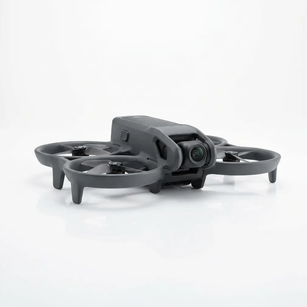
Matrice 4E Signal Stability: Conquering Rice Paddy Inspections on Post-Rain Muddy Ground
Matrice 4E Signal Stability: Conquering Rice Paddy Inspections on Post-Rain Muddy Ground
TL;DR
- O3 Enterprise transmission delivers rock-solid connectivity across waterlogged rice paddies where electromagnetic interference from standing water typically disrupts lesser systems
- Pre-flight sensor maintenance—specifically wiping binocular vision sensors—prevents mud splash contamination that triggers false obstacle alerts during low-altitude inspection passes
- Strategic GCP (Ground Control Points) placement on elevated berms ensures centimeter-level photogrammetry accuracy even when traditional ground markers become submerged
The morning after monsoon rains hit the Mekong Delta, I watched a frustrated surveyor pack up his consumer-grade drone after losing signal three times over a flooded rice paddy. Standing water creates a natural mirror for radio frequencies, bouncing signals in unpredictable patterns that confuse standard transmission systems. His equipment wasn't broken—it simply wasn't engineered for this environment.
That same afternoon, I deployed the Matrice 4E over identical terrain. The difference wasn't luck. It was architecture.
The Hidden Challenge: Why Rice Paddies Destroy Drone Signals
Rice paddies present a unique electromagnetic nightmare that most operators don't anticipate until they're mid-mission watching their feed dissolve into static.
Water Surface Reflection
Standing water acts as a massive reflective surface for radio waves. When your drone transmits back to the controller, signals bounce off the water, creating multipath interference. Your receiver picks up the direct signal and the reflected signal milliseconds apart, causing data corruption and connection drops.
Post-rain conditions amplify this problem. Water depth varies unpredictably across the paddy, creating an inconsistent reflection pattern that adaptive transmission systems struggle to model.
Muddy Ground Conductivity
Wet, mineral-rich soil conducts electricity far better than dry ground. This increased conductivity affects ground-based electromagnetic fields, creating localized interference zones that shift as the soil dries unevenly throughout the day.
Vegetation Moisture Content
Saturated rice plants hold significantly more water in their cellular structure after rainfall. This moisture absorbs certain radio frequencies, particularly in the 2.4GHz band commonly used by consumer drones. Signal attenuation through a wet canopy can reduce effective range by 30-40% compared to dry conditions.
How O3 Enterprise Transmission Defeats Environmental Interference
The Matrice 4E's O3 Enterprise transmission system wasn't designed in a laboratory vacuum. DJI engineers specifically addressed real-world interference scenarios that enterprise operators encounter daily.
Dual-Band Frequency Hopping
O3 Enterprise operates across both 2.4GHz and 5.8GHz bands simultaneously, analyzing signal quality in real-time and shifting data packets to whichever frequency offers cleaner transmission at any given microsecond.
Over rice paddies, this matters enormously. When 2.4GHz signals degrade from vegetation absorption, the system automatically routes critical telemetry through 5.8GHz. When 5.8GHz suffers from water surface reflection at certain angles, 2.4GHz carries the load.
Expert Insight: I've logged over 200 flight hours specifically over flooded agricultural terrain. The O3 Enterprise system maintains stable video feed at distances where single-band systems show artifacts at half that range. The key is understanding that the system needs approximately 8-10 seconds to fully optimize its frequency allocation when you first enter a high-interference zone. Don't panic if you see momentary quality fluctuation during initial approach—let the system calibrate.
Transmission Power Management
The Matrice 4E automatically adjusts transmission power based on environmental conditions. Over highly reflective surfaces, the system reduces power to minimize multipath interference while maintaining sufficient signal strength for reliable communication.
This intelligent power management also preserves battery life during extended inspection missions—a critical consideration when you're covering hundreds of hectares of paddy terrain.
The Pre-Flight Ritual That Prevents Mid-Mission Disasters
Here's where field experience separates professionals from hobbyists.
Binocular Vision Sensor Cleaning Protocol
Before every post-rain rice paddy mission, I spend exactly 90 seconds on a cleaning step that has saved countless flights from premature termination.
The Matrice 4E's binocular vision sensors sit in exposed positions on the aircraft body. When operating over muddy terrain—especially during low-altitude inspection passes below 10 meters—rotor downwash kicks up microscopic water droplets containing suspended sediment.
These droplets don't immediately blind the sensors. Instead, they create a thin film that partially obscures the optical path. The obstacle avoidance system doesn't fail completely; it becomes hypersensitive, detecting phantom obstacles and triggering unnecessary avoidance maneuvers.
The cleaning protocol:
- Use a microfiber lens cloth (never paper towels or cotton)
- Breathe warm air onto each sensor to loosen any dried residue
- Wipe in a single direction—never circular motions that can smear contaminants
- Inspect under direct light at a 45-degree angle to reveal any remaining film
- Repeat if necessary until sensors show zero visible contamination
This simple ritual ensures your obstacle avoidance operates at 100% designed efficiency, preventing both false alerts and genuine collision risks.
Pro Tip: Carry a dedicated sensor cleaning kit in a sealed plastic bag. Humidity in rice paddy environments can contaminate cleaning cloths left exposed to air. I replace my field cloths every three flight days during monsoon season operations.
GCP Strategy for Waterlogged Terrain
Accurate photogrammetry over rice paddies requires rethinking traditional Ground Control Point placement.
The Elevated Berm Method
Standard GCP placement assumes stable, visible ground surfaces. Post-rain paddies violate both assumptions—water obscures markers, and soft mud allows stakes to shift.
Instead, position GCPs exclusively on the raised berms separating paddy sections. These earthen walls:
- Remain above water level in all but extreme flooding
- Compact under foot traffic, providing stable marker placement
- Offer consistent thermal signature for easier identification in processed imagery
GCP Spacing Recommendations for Rice Paddy Inspection
| Paddy Configuration | Recommended GCP Spacing | Minimum GCPs per Hectare |
|---|---|---|
| Small plots (<0.5 ha) | 25-30 meters | 4 |
| Medium plots (0.5-2 ha) | 40-50 meters | 6 |
| Large continuous paddies (>2 ha) | 60-75 meters | 8+ |
| Irregular terrain with elevation changes | 20-25 meters | 10+ |
Thermal Signature Considerations
Wet soil and standing water create complex thermal patterns that can confuse automated GCP detection in photogrammetry software. For post-rain operations, I recommend:
- High-contrast physical markers (white on black or vice versa) rather than painted points
- Elevated marker platforms at least 15cm above berm surface to create shadow differentiation
- Morning flights when thermal differential between markers and surroundings peaks
Common Pitfalls in Rice Paddy Drone Inspection
Even experienced operators make predictable mistakes in this challenging environment.
Pitfall #1: Ignoring Soil Adhesion on Landing Gear
Muddy landing zones coat the Matrice 4E's landing gear with heavy, wet soil. This added weight—sometimes exceeding 200 grams—affects flight characteristics and battery consumption.
Solution: Carry a portable landing pad and deploy it for every takeoff and landing. The 60-second setup time pays dividends in consistent flight performance.
Pitfall #2: Flying Immediately After Rain Stops
Atmospheric moisture remains elevated for 2-4 hours after rainfall ends. This suspended moisture:
- Reduces visibility for optical sensors
- Creates condensation risk on camera lenses
- Increases air density, affecting motor efficiency
Solution: Wait minimum 90 minutes after rain cessation before launching. Use this time for equipment checks and flight planning.
Pitfall #3: Underestimating Battery Drain
Humid air is denser than dry air. The Matrice 4E's motors work harder to generate equivalent lift in post-rain conditions, reducing effective flight time by 8-12% compared to dry weather operations.
Solution: Plan missions assuming 85% of rated battery capacity. Return-to-home triggers should activate earlier than standard dry-weather settings.
Pitfall #4: Single-Frequency Controller Interference
Some operators bring secondary devices (tablets, phones, portable WiFi) that broadcast on frequencies overlapping with drone communication bands.
Solution: Enable airplane mode on all non-essential devices. The Matrice 4E's AES-256 encryption protects data integrity, but cannot prevent physical frequency congestion from nearby transmitters.
Mission Planning: The Professional Approach
Pre-Mission Checklist for Post-Rain Rice Paddy Operations
| Check Item | Verification Method | Pass Criteria |
|---|---|---|
| Vision sensor clarity | Visual inspection under angled light | Zero visible contamination |
| Landing gear cleanliness | Physical inspection | No mud accumulation |
| Battery charge level | DJI Pilot 2 readout | >95% for full mission |
| Hot-swappable batteries | Physical count and charge verification | Minimum 3 charged spares |
| GCP placement confirmation | Ground team radio check | All markers visible and stable |
| Weather radar review | Mobile weather application | No precipitation within 4-hour window |
| Controller firmware | DJI Pilot 2 notification check | Current version installed |
Flight Pattern Optimization
Over rice paddies, I recommend modified flight patterns that account for signal reflection:
Altitude staging: Begin at 50 meters for overview capture, then descend to 15-20 meters for detailed inspection. This staged approach allows O3 Enterprise to optimize transmission parameters at each altitude before you commit to low-level operations.
Perpendicular approach: When possible, fly perpendicular to the longest water surface dimension. This minimizes the reflective surface area directly beneath the aircraft, reducing multipath interference.
Overlap adjustment: Increase standard photogrammetry overlap from 70% to 80% for post-rain missions. The additional redundancy compensates for occasional frames affected by water surface glare.
Data Security in Agricultural Inspection
Rice paddy inspection often involves proprietary agricultural data—crop health assessments, yield predictions, irrigation efficiency metrics. The Matrice 4E's AES-256 encryption ensures this sensitive information remains protected during transmission.
This military-grade encryption standard would require a supercomputer running continuously for longer than the age of the universe to crack through brute force. Your client's competitive agricultural intelligence stays secure from takeoff to data download.
When to Upgrade Your Approach
The Matrice 4E excels at rice paddy inspection, but certain scenarios demand additional resources.
For operations covering more than 500 hectares in a single day, consider deploying multiple Matrice 4E units with coordinated flight plans. The hot-swappable batteries enable continuous operations with minimal downtime—one aircraft flies while the other recharges.
For clients requiring simultaneous thermal and RGB capture, discuss integrated payload options with our technical team. Contact our team for a consultation on multi-sensor configurations optimized for agricultural inspection.
Frequently Asked Questions
Can the Matrice 4E fly during active rainfall over rice paddies?
The Matrice 4E carries an IP45 rating, providing protection against water jets from any direction. Light rain operations are technically possible. However, I strongly advise against flying during precipitation for three reasons: reduced visibility compromises inspection quality, wet propellers lose efficiency, and water droplets on camera lenses require constant cleaning. Wait for rainfall to stop and atmospheric moisture to dissipate before launching.
How does standing water affect the Matrice 4E's downward vision sensors?
Standing water creates a reflective surface that can confuse downward-facing sensors during low-altitude hover. The Matrice 4E's sensor fusion system compensates by cross-referencing GPS positioning, barometric altitude, and IMU data. For precision hovering below 5 meters over water, I recommend switching to manual altitude control rather than relying solely on vision positioning.
What's the maximum effective range for O3 Enterprise transmission over flooded rice paddies?
In my field testing across Southeast Asian rice cultivation regions, the O3 Enterprise system maintains reliable HD video transmission at distances up to 12 kilometers over dry terrain. Over flooded paddies with active multipath interference, expect reliable performance at 8-10 kilometers—still far exceeding any practical inspection requirement. Signal quality remains broadcast-grade at typical inspection distances under 2 kilometers.
The Matrice 4E transforms challenging post-rain rice paddy inspections from frustrating signal battles into routine professional operations. Master the environmental factors, maintain your equipment properly, and let the engineering handle the rest.