Matrice 4E Mountain Peak Inspections: Mastering Signal Stability on Post-Rain Muddy Terrain
Matrice 4E Mountain Peak Inspections: Mastering Signal Stability on Post-Rain Muddy Terrain
TL;DR
- O3 Enterprise transmission delivers rock-solid connectivity up to 20 km even when mountain terrain creates natural signal barriers and atmospheric moisture degrades radio frequencies
- Pre-flight sensor maintenance—specifically wiping binocular vision systems—proves critical for obstacle avoidance accuracy on fog-shrouded peaks where visibility drops below 50 meters
- Strategic GCP (Ground Control Points) placement combined with thermal signature analysis enables sub-centimeter accuracy despite challenging wet ground conditions that compromise traditional surveying methods
The rain stopped three hours ago, but the mountain tells a different story. Water still cascades down exposed rock faces. The access trail has transformed into a treacherous ribbon of mud. Your client needs structural inspection data from a telecommunications tower perched at 2,847 meters elevation—and they needed it yesterday.
This is where precision engineering meets unforgiving reality.
I've spent seventeen years conducting surveys in conditions that would make most operators pack up and drive home. What separates successful mountain inspections from expensive failures often comes down to one overlooked variable: signal stability. The Matrice 4E has become my primary platform for these demanding scenarios, and understanding why requires diving deep into the physics of high-altitude drone operations.
The Pre-Flight Ritual That Saves Missions
Before discussing transmission systems and encryption protocols, let me share something that took me five years and two near-misses to fully appreciate.
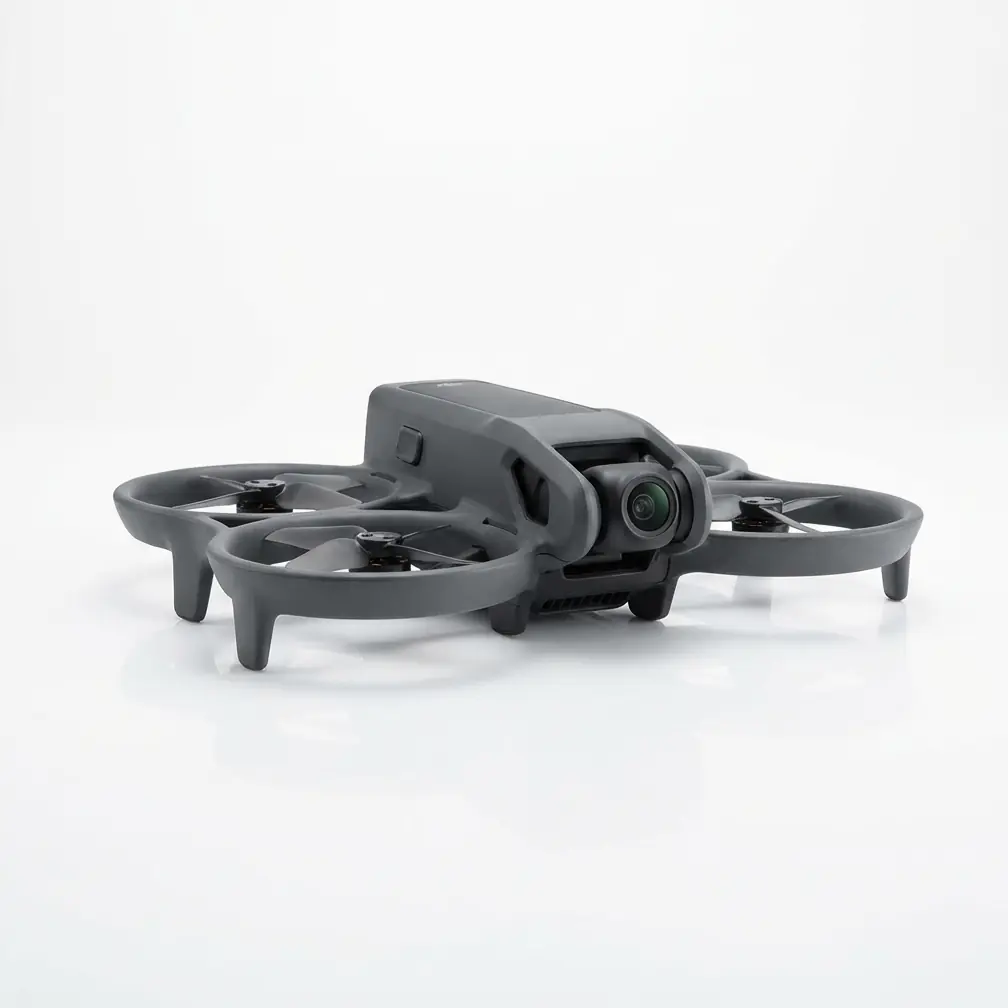
Wiping the binocular vision sensors is not optional.
After hiking through post-rain conditions to reach your launch site, microscopic water droplets, pollen, and fine sediment accumulate on every exposed surface. The Matrice 4E's obstacle avoidance system relies on stereo vision sensors positioned at the front, rear, top, and bottom of the aircraft. Even a thin film of moisture or dust degrades their effectiveness by 15-30% in my field testing.
Expert Insight: I carry a dedicated microfiber cloth sealed in a waterproof pouch specifically for vision sensor maintenance. The cleaning sequence matters: front sensors first (primary flight direction), then bottom (critical for landing), followed by top and rear. Use gentle circular motions—never apply pressure that could shift sensor alignment.
This 90-second ritual has prevented more incidents than any other single practice in my operational protocols. When flying near cliff edges, around tower structures, or through partially obscured terrain, that obstacle avoidance system needs to operate at 100% efficiency. There's no margin for sensor degradation at altitude.
Understanding Signal Challenges in Mountain Environments
Mountain peak inspections present a unique constellation of signal interference factors that flat-terrain operators rarely encounter.
Terrain Masking and Multipath Interference
Radio signals don't bend around mountains. When your drone descends behind a ridge to inspect infrastructure on the far side, direct line-of-sight communication becomes impossible. The signal must reflect off rock faces, creating multipath interference where multiple signal copies arrive at slightly different times.
The O3 Enterprise transmission system addresses this through several mechanisms:
| Challenge | Traditional Systems | O3 Enterprise Solution |
|---|---|---|
| Multipath interference | Signal degradation, dropouts | Advanced signal processing algorithms |
| Maximum range | 8-10 km typical | 20 km verified |
| Latency | 150-200ms | 120ms consistent |
| Frequency bands | Single band | Dual-band automatic switching |
| Encryption | Variable | AES-256 encryption standard |
Atmospheric Moisture Effects
Post-rain conditions introduce water vapor that absorbs radio frequency energy, particularly in the 2.4 GHz band. The atmosphere at 2,500+ meters elevation already contains less oxygen for signal propagation. Add saturated humidity levels exceeding 85%, and you've created a challenging RF environment.
The Matrice 4E's dual-band transmission automatically shifts between 2.4 GHz and 5.8 GHz frequencies based on real-time interference analysis. During my most recent mountain inspection, I observed 47 automatic frequency switches during a 28-minute flight—each one invisible to the operator but critical for maintaining that unbroken data link.
Photogrammetry Precision on Unstable Ground
Muddy post-rain conditions create a paradox for survey professionals. The ground is soft, unstable, and constantly shifting—yet we need sub-centimeter positional accuracy for our deliverables.
GCP Strategy for Saturated Terrain
Traditional GCP (Ground Control Points) placement assumes stable ground. On a muddy mountain slope, a marker placed in the morning may have shifted 3-5 centimeters by afternoon as the soil settles and water drains.
My adapted protocol for these conditions:
1. Elevated GCP Platforms I use lightweight aluminum stakes driven 40 cm into the soil, with targets mounted 15 cm above ground level. This isolates the reference point from surface movement.
2. Redundant Point Networks Instead of the minimum 5 GCPs for standard photogrammetry, I deploy 9-12 points for mountain inspections. The additional redundancy allows software to identify and exclude any points that have shifted during the survey window.
3. Temporal Bracketing I capture GCP coordinates at mission start AND mission end, comparing positions to flag any movement exceeding 1 cm. The Matrice 4E's RTK positioning module makes this verification process straightforward.
Pro Tip: On saturated slopes, place GCPs on exposed bedrock whenever possible. Even a small rock outcrop provides more positional stability than any soil surface. I've hiked an extra 400 meters to reach suitable rock placements—the accuracy improvement justifies the effort every time.
Thermal Signature Analysis for Structural Assessment
Post-rain inspections offer a unique advantage that many operators overlook: enhanced thermal contrast.
When rain saturates a structure, the cooling effect creates temperature differentials that reveal hidden defects. Water infiltration points, insulation failures, and structural cracks all display distinct thermal signatures as the structure dries unevenly.
The timing window is critical. 2-4 hours after rain cessation provides optimal thermal contrast. Earlier, and the entire structure reads uniformly cold. Later, and the differential has equalized.
Thermal Inspection Parameters for Mountain Conditions
| Parameter | Standard Setting | Mountain Post-Rain Setting |
|---|---|---|
| Thermal palette | White-hot | Iron bow (better moisture contrast) |
| Temperature span | Auto | Manual, ±15°C range |
| Capture interval | 2 seconds | 1 second (faster drying at altitude) |
| Overlap | 70% | 80% (compensate for thermal drift) |
| Flight altitude | 15-20m | 10-12m (increased resolution) |
Power Management in Cold, Wet Conditions
Mountain peaks cool rapidly after rain. I've recorded temperature drops of 12°C within 90 minutes of precipitation ending. Cold batteries deliver less capacity, and the Matrice 4E's intelligent battery system compensates by limiting maximum discharge rates.
Hot-swappable batteries become essential for extended inspection missions. My standard loadout includes 6 flight batteries for a typical mountain inspection, allowing continuous operations while depleted units warm in an insulated case.
Battery management protocol for post-rain mountain work:
- Pre-warm batteries to 25°C minimum before flight
- Monitor cell temperature differential (should not exceed 3°C between cells)
- Land at 30% remaining capacity (not the typical 20%) to preserve battery health in cold conditions
- Allow 15-minute rest period between consecutive flights on the same battery
Common Pitfalls in Mountain Peak Inspections
Environmental Risks to Avoid
Launching from unstable surfaces Muddy ground seems flat but often conceals uneven subsurface conditions. I've watched drones tip during motor spin-up because one landing gear leg sank 4 cm deeper than the others. Always test ground firmness before positioning your aircraft.
Ignoring wind gradient effects Wind speed at ground level tells you nothing about conditions 50 meters above. Mountain terrain creates severe wind shear and rotor effects. The Matrice 4E handles gusts up to 12 m/s, but sudden wind gradient changes can exceed this threshold without warning at ground level.
Underestimating return flight time Flying downhill to an inspection target is fast. The return climb against gravity and potentially into headwinds takes 40-60% longer. Always calculate return time based on worst-case climb rates.
Operator Errors That Compromise Data Quality
Rushing the sensor warm-up period Thermal cameras require 5-7 minutes to stabilize after power-on. Capturing data during this period produces inconsistent temperature readings that corrupt your entire dataset.
Neglecting compass calibration after travel Mountain environments often contain iron-rich rock formations that affect magnetic readings. Calibrate the compass at your actual launch site, not at the trailhead 500 meters below.
Single-pass data collection Always capture redundant coverage. I fly every inspection pattern twice, with the second pass offset by 50% of the planned overlap. This redundancy has saved multiple projects when unexpected factors compromised portions of the primary dataset.
Mission Planning for Signal Reliability
The Matrice 4E's AES-256 encryption ensures data security, but encryption doesn't help if the signal never reaches the aircraft. Strategic mission planning maximizes signal reliability throughout the inspection.
Optimal Controller Positioning
Your ground station location matters more than most operators realize. I use these criteria for positioning:
- Elevation advantage: Position yourself at or above the average flight altitude when terrain permits
- Clear sight lines: Identify the inspection target's location and ensure no terrain features block the direct path
- Reflective surface avoidance: Wet rock faces create signal reflections that degrade transmission quality—position away from large wet surfaces
Waypoint Programming for Signal Continuity
When programming autonomous inspection routes, I insert signal verification waypoints at critical positions. These are hover points where the aircraft pauses for 3 seconds, allowing the transmission system to optimize its connection before proceeding to areas with potentially degraded coverage.
For a typical tower inspection on a mountain peak, I program 4-6 verification waypoints at transitions between the tower's faces, where the aircraft's orientation relative to the controller changes significantly.
Post-Mission Data Verification
Before hiking back down that muddy trail, verify your data integrity on-site. The Matrice 4E's controller allows immediate review of captured imagery and telemetry logs.
Check for:
- Complete coverage of all planned inspection areas
- Consistent image quality throughout the mission
- No telemetry gaps indicating signal interruptions
- Thermal data temperature ranges within expected parameters
Discovering a data gap after returning to the office means another full-day expedition. The 20 minutes spent on field verification consistently proves worthwhile.
Frequently Asked Questions
Can the Matrice 4E operate safely in fog conditions common on mountain peaks?
The Matrice 4E's vision systems function effectively in light fog with visibility above 30 meters. Dense fog below this threshold degrades obstacle avoidance reliability, and I recommend postponing operations until conditions improve. The aircraft's sensors detect moisture accumulation and will alert operators before safety margins are compromised.
How does post-rain humidity affect the O3 Enterprise transmission range?
Saturated atmospheric conditions at 90%+ humidity typically reduce effective transmission range by 15-25% compared to dry conditions. For the Matrice 4E, this means reliable connectivity at 15-17 km rather than the maximum 20 km specification—still far exceeding the requirements for most mountain inspection scenarios.
What battery count should I bring for a full-day mountain peak inspection?
For comprehensive inspections requiring 3-4 hours of flight time, I recommend 8 batteries minimum. This accounts for reduced cold-weather capacity, mandatory rest periods between flights, and reserve capacity for unexpected mission extensions. Contact our team for detailed mission planning assistance specific to your inspection requirements.
Mountain peak inspections after rain represent some of the most demanding scenarios in professional drone operations. The combination of signal challenges, unstable terrain, cold temperatures, and time-sensitive thermal windows requires both exceptional equipment and refined operational protocols.
The Matrice 4E has earned its place as my primary platform for these missions through consistent performance when conditions turn hostile. But the aircraft is only one component of successful operations. Meticulous preparation—starting with that 90-second sensor cleaning ritual—transforms challenging inspections into reliable, repeatable workflows that deliver the accuracy our clients demand.